Cost-effective Aerial Imaging Solutions
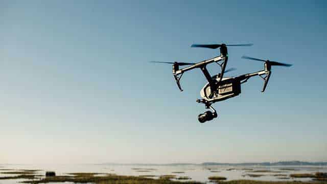
360Pros is a Transport Canada authorized UAV (drone) production service, able to capture from simple to complex scenarios. Whether you need film production for real estate or commercial projects, mapping and surveying, inspections, or agriculture, drones are saving time and money in your industry.
How we can help
Aerial Video & Photography
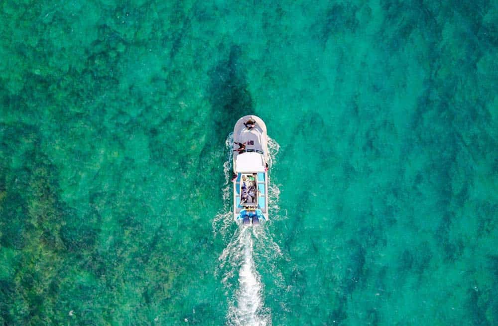
Our unmanned aerial vehicles are equipped with high-resolution photo and video cameras with an array of lenses able to capture birds-eye perspectives for documentaries, commercial films, real estate and more. We help our clients tell their stories and achieve cinematic footage through discreet flyovers in before impossible locations.
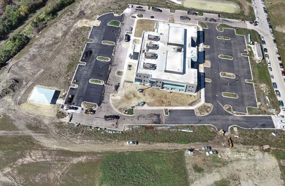
Mapping & Surveying
360Pros uses drones armed with RGB & LiDar sensors to capture dimensually accurate actionable data for fast project turnaround. This means quick and accurate stock pile volumetric calculations, survey-grade accuracy to the cm, digital elevation models, plus 2D and 3D photogrammetry data.
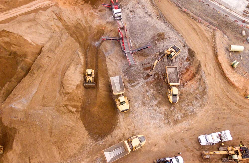
Industrial Solutions
Improve safety and minimize risk with drones by surveying sites for dangers before human traffic is introduced. 360Pros helps the mining industry track progress daily or weekly with thermal and geographic datasets. We can track and monitor pipeline status, accessing hard-to-reach places and flying closer than any other aircraft.
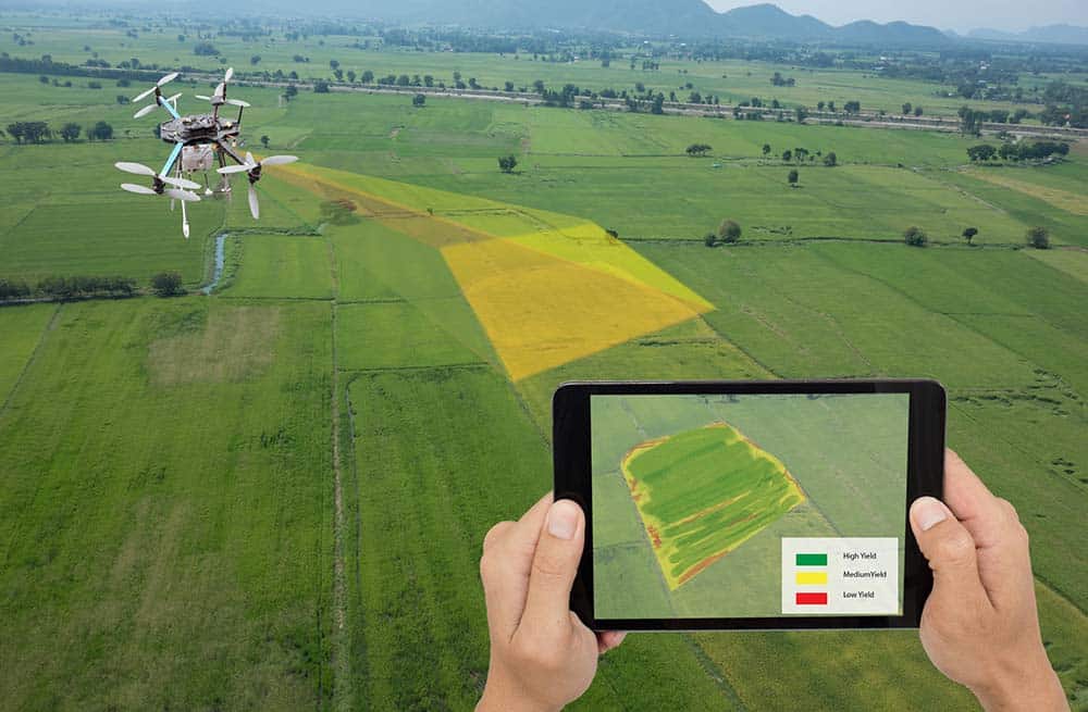
Inspections & Agriculture
Drones equipped with thermal imaging cameras help predict plant health and changes in crops, irrigation and soil quality. Multi-spectral thermal cameras convert heat into an image depicting surface temperatures, giving professionals in energy, search & rescue, roofing, HVAC, and HazMat fast and actionable data.
Dennis Thomas – Business Development Manager, Tsleil-Waututh Nation
“360Pros produced an bird’s eye view showcasing the potential developments of the Tsleil-Waututh Nation for generations to come. The technology made available was second-to-none, and very well received.”
Our Approach


Recent project with the Tsleil-Waututh Nation
We joined the Tsleul-Waututh First Nation and journeyed on boat to their ancestral grounds down the Indian Arm, capturing the entire trip by drone and from the ground.
- Documented the first-of-its-kind trip for future generations
- Aerial perspective never-before captured
- Shared the stories of indigenous heritage
- Gave elders who aren’t able to travel a chance to experience the journey on film